The making of a Classic Portland Snowstorm.
Just a short post about the weather because its the middle of winter and we just experienced a classic Portland winter situation. It wasn’t major or destructive but it was a classic set up that a gardener should be aware of in the future because it has happened innumerable times in the past and it will happen in the future. I’ll try to explain it in a way that is easy to understand and show some of the things to look for and how a classic Portland snow/ice storm sets up.
The Jet Stream and damn cold
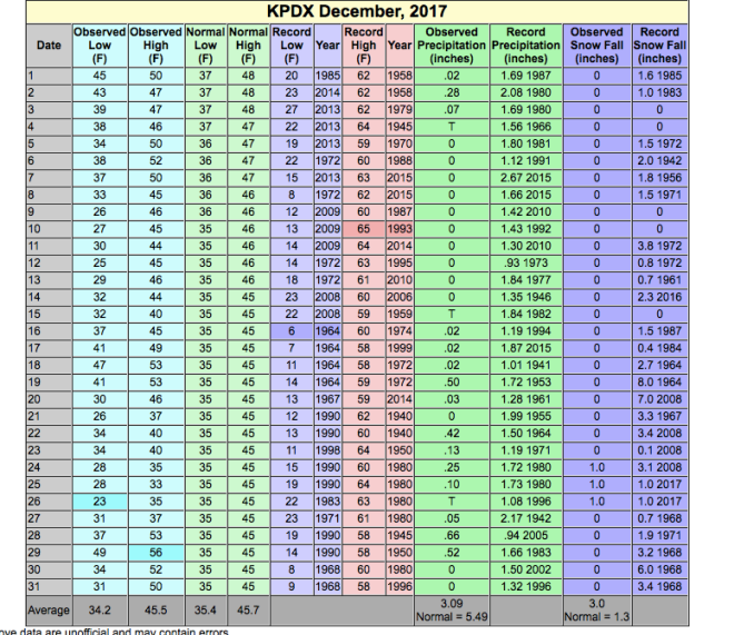
We had a remarkably active jet stream throughout the month of December. It landed us with a record amount of rain for the month and aside from sodden hillsides and swollen rivers it pretty much soaked our gardens. For several weeks warm, then progressively colder storms streamed in, soaked us and then repeated. So it was not a surprise at all when the jet stream not only backed off it split. VERY El Nino. In fact, research shows that the strongest El Ninos produce some pretty prodigious rains for the PNW before turning the Jet Stream to the south. In the last week of December what is known as a REX block stopped storms from impinging on our region. High pressure- thats air that is sinking and drying- in a clockwise motion stopped the storms and with a slight northeast bent it ushered in very cold, (not quite arctic) dry air east of the Cascades. The jet stream dropped to our south into Northern California.
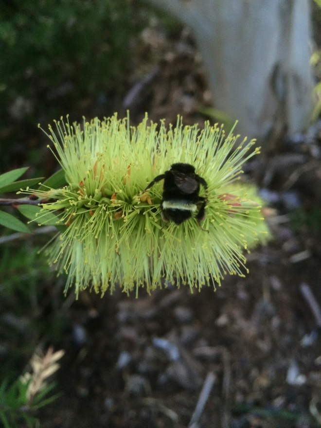
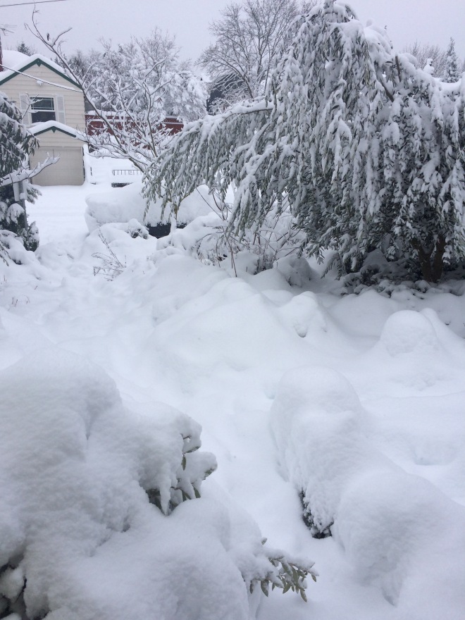
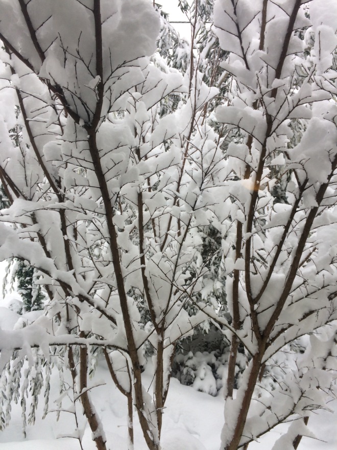
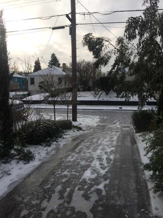 Wintery Scene
A Bora Wind
Cold high pressure enveloped the Columbia Basin where dense dry and almost arctic air collected. The Columbia River Gorge is a sea level path through the mountains. As low pressure centers rode the jet stream into N. California it set up a dynamic sucking the cold dry air through the Gorge. So- there was low pressure to the south west and high pressure to the north east. The perfect set up for an easterly flow. Air flows from high to low pressure and in this configuration its sent blasting through the gorge. A Bora wind. This steep pressure gradient was responsible for the wind that lashed Portland for several days at the end of December and beginning of the New Year. A pressure gradient can be likened to a ball rolling down a slope. The steeper the slope (closer the bars of pressure are aligned ) the faster the ball rolls and the steeper the gradient the faster the air goes. Confined to the slim width of the Gorge and you have yourself some wind. On top of this the Columbia Basin and eastern Oregon, the source of our cold air was refrigerating in a large and expansive low elevation snow pack. Cold. As you were aware that frigid air moved into the Portland area and down the Valley. It even blasted out of the east facing canyons at the beach.
Dewpoint, down, down, down
Two things to watch when an east wind (Bora) wind sets up are the temperatures at the source of the wind and then the dew point. Cold air is dry air- the colder it is the less moisture air can hold. (The molecules are closer together). Without going into graphic detail, lets just say that you should be aware of the dew point in Troutdale because they are at the front doorway of cold dry conditions. I watched the dew point dip day after day through the twenties and down into the teens. Tell tale signs of not only the measure of the atmosphere but the depth of cold air at the surface. Typically several days into an east wind event the temperatures at Troutdale will not plunge- but the mixing of the air will keep the temperature up. The dew point however, is where to look, it edges steadily lower. The other important clue is the temperatures east of the Cascades. If it is in the teens or single digits in Pendleton and the teens or colder in The Dalles- thats where our air originates and pressure gradients are shipping it to us directly. Those conditions were present.
A (weak) moisture source
What happened on January 2nd was a classic set up for snow and then freezing rain in Western Oregon. The cold, dry air that had been flooding the western part of the state became entrenched at the surface. Remember, cold air is dense and it follows the contours of the ground- it sticks close to the surface it fills up the valleys and canyons. Slowly, the rex block high pressure that had capped our atmosphere gave way to lower pressure edging north from California. Moisture rode northward and over topped the cold air. I should say that if a storm is strong and comes barreling in it will scour out the cold air at the surface and there is a faster transition. This time, the weakness of the system moving north left the air in place and after days of easterly flow cold air was deep. The first precipitation to fall into that air mass began as snow and ended in freezing rain. The large difference between the air temperature and the dew point (humidity) shows the large depth of cold air. And hence we got about 1.5″ to 2.5″ of fluffy snow in the morning of the 3rd. More was to come.
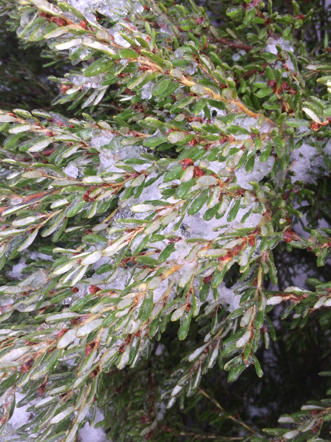
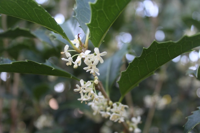
Grevillea australis all iced up.
A Silver Thaw
This is a term I learned as a child and its fallen out of modern favor instead replaced by more scientific lingo. Yes, we are all becoming junior meteorologists, but from the past I bring up ‘Silver Thaw’ because it was well known to our predecessors and it is so aptly descriptive. Freezing rain occurs when the layer of cold air over us is eroded and over topped by warmer air and moisture. Precipitation begins as snow, falls into warm air and melts and then if the layer of cold air at the surface is deep it refreezes. Technically, this is sleet – its the ice balls that bounce and pelt you. As the warm air becomes deeper (eroding the cold surface air) rain does not refreeze, instead it remains liquid but becomes super cooled and it will freeze on contact with every surface- the temperature is below freezing but rain is falling. Glazing, is the term but I prefer ‘Silver Thaw’- harkening back to true Oregonian roots. Typically, in this set up the East Wind continues to pour cold air into the western valleys and is met by more moisture over riding from the west and south. We were lucky this time that the storm was not particularly wet. Hence, we had only about .25″ of ice and we escaped real tree damage and a prolonged bout. Warm air then wins out- the perfectly applicable term ‘Silver Thaw’. The Pioneers knew what they were talking about.
That may be it for winter
I probably don’t need to point out that the window for truly arctic air to come into our gardens is waning quickly. Typically the final gasp of that kind of air dies around Valentines Day. It can get cold after that and certainly freeze but true arctic air is extremely rare and as far as I am concerned that is spring. So long term forecasts are not showing any real set up for arctic air. We could be out of the woods. I’ll continue to watch it closely and chime in if I see anything that looks dangerous. Until then, we are probably looking at the second zone 9 winter in a row. YAY.
-Paul